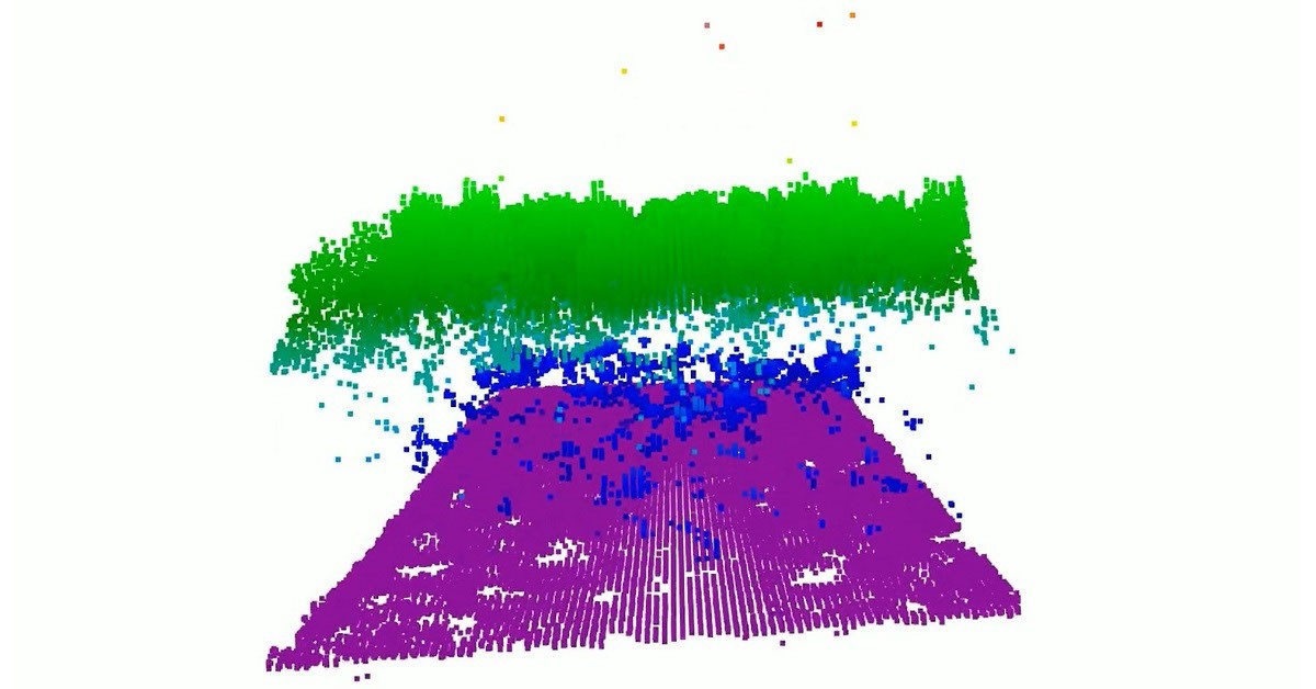
A new instrument developed by researchers at NASA’s Goddard Space Flight Center aims to enhance the mapping of Earth’s surface using advanced lidar technology. The Concurrent Artificially-intelligent Spectrometry Lidar System (CASALS) integrates machine learning and an ultra-compact lidar design to fill in measurement gaps traditionally seen in space-based observations.
Innovation in Remote Sensing
CASALS represents a significant advancement in remote sensing capabilities by allowing for the capture of three-dimensional topographical data over large areas. Unlike conventional lidar systems that rely on mechanical movement to steer lasers, CASALS employs a novel method that manipulates laser wavelengths to create a continuous swath of data, thereby eliminating blind spots between measurement lines.
John Yorks, a physical research scientist at NASA and the Principal Investigator for CASALS, highlighted the instrument’s unique transmitter and optical grating system that avoids the use of heavy and potentially failure-prone moving parts. The technology utilizes a fast-pulsing, tunable laser that cycles through 256 wavelengths, enabling it to generate detailed topographical renderings.
Performance and Future Plans
CASALS has already demonstrated its capabilities through airborne testing. In November 2024, a prototype flew on NASA’s B200 King Air aircraft and successfully produced high-quality scientific data during its initial campaign. Yorks expressed his admiration for the team’s performance, noting the instrument’s ability to distinguish detailed features such as individual tree branches and subtle changes in ground elevation.
Looking ahead, the CASALS team plans to conduct further flights as part of the Airborne Surface, Cryosphere, Ecosystem, and Nearshore Topography (ASCENT) campaign, scheduled for summer 2027. They also intend to enhance the technology by widening the instrument’s swath and incorporating onboard data processing capabilities to prepare for future space missions.
Potential Impact on Earth Science
If successful, CASALS could revolutionize the way scientists study Earth’s forests and terrain by providing comprehensive three-dimensional maps rather than isolated profiles. This advancement could significantly improve understanding of environmental changes and aid in various scientific fields related to Earth science.
The project is supported by NASA’s Decadal Survey Incubation program, NASA’s Instrument Incubation Program, and collaborations with the University of California, Santa Barbara, and Virginia Polytechnic Institute and State University.
Source: NASA