Some 27 million years ago, a volcano in southeastern Arizona produced massive eruptions that spread volcanic material across the landscape, exceeding the output of Mount St. Helens in 1980 by over 1,000 times. This event created a significant geological feature known as the Turkey Creek caldera, which is 12 miles wide and nearly 4,900 feet deep.
Formation of Unique Geological Features
The explosive volcanic activity blanketed the area, which is part of the Chiricahua Apache Nation’s traditional lands, with ash and pumice. The eruptions resulted in extensive pyroclastic flows that solidified into thick deposits of welded rhyolitic tuff, some reaching depths of nearly 1,600 feet. Over time, processes such as erosion and weathering sculpted these deposits into dramatic formations, including spires, hoodoos, and canyons that characterize the region today.
The Apache named this area “The Land of the Standing-Up Rocks,” reflecting the striking rock formations, including towering pinnacles and notable features like Big Balanced Rock. Visitors can explore Rhyolite Canyon and Bonita Canyon, which are filled with unique rock formations and dense vegetation. The area was designated a national monument in 1924 and was recently redesignated as Chiricahua National Park in October 2026.
Diverse Ecosystems and Flora
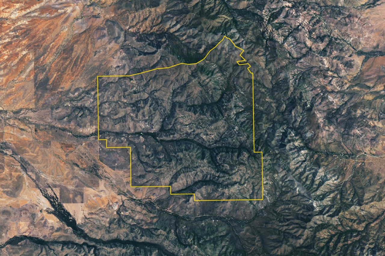
The park, captured in a cloud-free image by the Operational Land Imager on Landsat 9 on July 2, 2026, showcases a variety of ecosystems with four biogeographic regions converging within its boundaries: the Sonoran Desert, Chihuahuan Desert, Rocky Mountains, and Sierra Madre. This convergence contributes to the park’s rich plant diversity, which includes over 1,000 species such as agaves, prickly pear cacti, yuccas, and various types of trees like pine and oak.
Chiricahua National Park is situated in the Chiricahua Mountains, part of a series of isolated mountain ranges known as “sky islands” that rise from the surrounding desert. The highest point in the range reaches 2,986 meters above sea level, standing more than 1,800 meters above the adjacent valley, further emphasizing the unique geological and ecological characteristics of this newly designated national park.
NASA Earth Observatory contributed to the documentation of this geological marvel, with imagery and analysis by Lauren Dauphin and a story by Adam Voiland providing insights into the significance of Chiricahua National Park.
Source: NASA